ILMSinfo / RBIS: Station
(→Station type and feature) |
(→Station type and feature) |
||
| Line 24: | Line 24: | ||
# Add one or more stations types ([Add]). | # Add one or more stations types ([Add]). | ||
| − | [[File:station_feature_add.jpg]] | + | [[File:station_feature_add.jpg]] |
The station type is mainly used to display stations in a map. | The station type is mainly used to display stations in a map. | ||
Revision as of 14:54, 5 December 2011
Contents |
Station dataset
Station description

Station name
The name of the station should be unique. If there is no real name available (e.g. in case of virtual stations) number your stations or use the coordinates for an unambiguous identification.
Jena
Lhasa_1980-2004
ECHAM5_29.75N_90.25E
NCCIMD_078
Station identifier
Identifier of the local measurement network.
Station location
The coordinates can be in any spatial reference system, but common ones (e.g. UTM or geographic coordinate system) are easier to handle in international projects.
The list of available Spatial Reference Systems is based on the PROJ.4 library for converting geospatial data to different coordinate reference systems. If one is missing in the list contact the RBIS administrator (guideline for admin).
Country
All countries or states can be displayed here. If one is missing in the list contact the RBIS administrator (guideline for admin).
Station type and feature
Add a station type after the creation of your station meta-data:
- Switch to the edit-mode of your dataset.
- Add one or more stations types ([Add]).
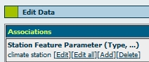

The station type is mainly used to display stations in a map.