Versions
JAMS is available in two flavors:
- as a Windows installer that allows easy setup on Windows systems, and
- as a platform-independent zip-archive which can be used to run JAMS on any platform that supports Java.
For information on how to install JAMS, please have a look here.
Features
Both versions contain the same functions and components, which include:
- JAMS runtime system with the core components needed to run JAMS models
- modelling libraries which contain more than 200 components that
- allow to simulate a wide range of hydrological and environmental processes, and
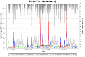
- provide functions for data analysis, data I/O and graphical visualization
- graphical user interfaces for
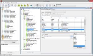
- building, configuring and running JAMS models (JAMS Launcher and JAMS Builder)
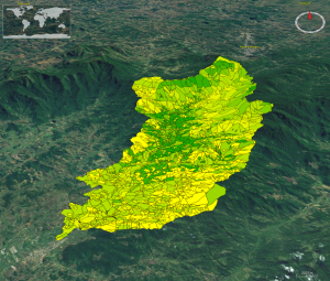
- analyzing and visualizing model input and output data (JAMS Data Explorer) including 3D map visualization using NASA World Wind
- a toolbox for model parameter optimization, sensitivity and uncertainty analysis (OPTAS) that can be used to calibrate and analyze any JAMS model
- an automated documentation generator based on DocBook and XSLT transformation and Apache FOP (currently Windows only)
Demo Models
In addition, JAMS comes with two test models that demonstrate a number of JAMS functions and that can serve as a blueprint to setup your own models. These models are:
- the USGS Thornthwaite model, a simple lumped water-balance model working on a monthly time step [1]
- the fully distributed hydrological process model J2K [2]
Both models are located in the "data" subdirectory of the JAMS installation. To run the model, follow these steps:
- Start the JAMS Builder and choose "File"->"Load Model..." from the main menu
- Navigate to the "data/j2k_gehlberg" ("data/thornthwaite") folder and choose the "j2k_gehlberg.jam" ("thornthwaite.jam") file to be opened
- Choose "Model"->"Run Model" from the main menu (or press the
 button from the toolbar) to start the simulation
[1] McCabe, G. J. & Markstrom, S. L. (2007). A Monthly Water-Balance Model Driven By a Graphical User Interface (Open-File Report No. 2007–1088). U.S. Geological Survey.
[2] Krause, P. (2002). Quantifying the impact of land use changes on the water balance of large catchments using the J2000 model. Physics and Chemistry of the Earth, Parts A/B/C 27(9–10), 663–673. doi:10.1016/S1474-7065(02)00051-7


